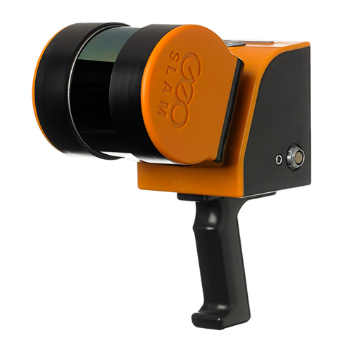
Used GeoSLAM ZEB REVO RT 3D Scanner
GeoSLAM ZEB REVO RT
GeoSLAM ZEB REVO RT Handheld, lightweight and easy to use, the ZEB Revo RT allows you to rapidly build highly accurate 3D models within minutes, while on the move.With powerful SLAM technology at its heart (we call it GeoSLAM Beam), the ZEB Revo RT can be used in areas with poor GPS – such as underground or in forests. The ZEB Revo RT can be paired with one of our many mounting options.
GeoSLAM ZEB REVO RT Handheld, lightweight and easy to use, the ZEB Revo RT allows you to rapidly build highly accurate 3D models within minutes, while on the move.With powerful SLAM technology at its heart (we call it GeoSLAM Beam), the ZEB Revo RT can be used in areas with poor GPS – such as underground or in forests. The ZEB Revo RT can be paired with one of our many mounting options.
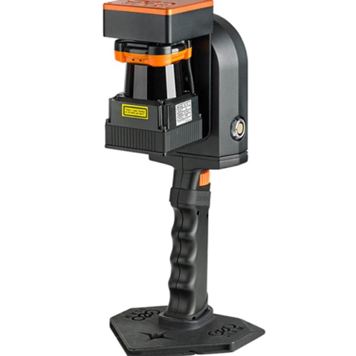
GeoSLAM ZEB REVO RT Elevate or lower your ZEB into difficult spaces like ceiling voids and manholes with the cradle or pole.
The Zeb Revo RT is “go-anywhere” 3D mobile mapping technology
Scan, process and track your progress as you go.
Handheld, lightweight and easy to use, the ZEB REVO RT allows you to rapidly build highly accurate 3D models within minutes, while on the move.
The complete solution that allows you to start mapping the world around you today with any WiFi enabled device. Scan, visualise and process simultaneously, as you walk.
- scans & processes simultaneously, as you walk
- handheld
- lightweight
- easy to use
- no need for GNSS
- 1-3 cm accuracy
- industry-standard file formats
Data capture is as simple as “walk and scan.” Map a 3-story building in just 30 minutes to an accuracy level of 15mm or scan, view and export up to 10,000 m2 (105,000 sq. ft.) in under 1 hour.
Join our customers as they measure building plans 10 times faster than traditional tools, deliver BIM models earlier than expected and experience project cost savings of up to two thirds.
This solution allows customers to expand their range and scope of services by taking on projects that would otherwise have proved too difficult or time-consuming using traditional techniques.
- Captures data up to 8X faster than with terrestrial scanners
- Saves time due to a fully automatic registration process
- Simple and efficient 2D plan generation
- No point cloud conversion for CAD required
Includes:
- 1x GeoSLAM ZEB REVO 3D Laser Scanner
- 1x ZEB CAM camera
- 1x GeoSLAM ZEB REVO RT datalogger
- 2x Rechargeable batteries
- Interface cables
- Charger
- Hard case for transport
- 1x GeoSLAM HUB license V5.2
- 1x GeoSLAM DRAW starter license
- 12 months Silver support contract